
Ocean proximity typically raises a home's market price because of amenity value and supply scarcity, but it can reduce net value where flood risk, insurance costs, and physical hazards are material. That tension is the core of why ocean proximity affects coastal home value, and it plays out differently in every market.
The primary drivers break down like this:
Amenity side (value-adding):
- Unobstructed sea views and direct beach access
- Ocean-driven microclimate (cooler summers, milder winters)
- Recreational lifestyle and perceived prestige
- Genuine scarcity of true waterfront parcels
Risk and cost side (value-reducing or cost-adding):
- Chronic sea-level rise and storm surge exposure
- Coastal erosion and salt corrosion
- Flood insurance premiums (National Flood Insurance Program and private)
- Higher maintenance costs and potential mortgage complications
A Yale School of Management analysis found that, at the national aggregate level, rising seas have not uniformly caused U.S. coastal property values to decline, which points to how powerfully buyer demand and scarcity can offset hazard signals. But that aggregate finding masks wide regional variation. NOAA tide-gauge data show local sea-level trends that differ sharply from one coastal city to the next, which is why a single national headline rarely tells you what is happening in a specific neighborhood.
Key Takeaways
Ocean proximity raises coastal home prices through amenity value and scarcity, but flood risk, insurance costs, and physical hazards can reduce net value significantly, and the balance differs by property, elevation, and market.
| Point | Details |
|---|---|
| Amenity premium is large and non-linear | Premiums for ocean views and waterfront access have been documented in hedonic studies as varying noticeably depending on view quality and location, with the effect concentrating within the first few hundred feet of shore. |
| Risk capitalization varies by market | Rising seas have not uniformly lowered U.S. coastal prices at the national level, but high-exposure, low-demand markets show durable discounts. |
| Insurance and recurring costs reduce net value | Flood, wind, and maintenance costs are material; a property that cannot be insured affordably shrinks its own buyer pool. |
| Due diligence requires specific tools | Verify FEMA flood zone, elevation certificate, ClimateCheck score, and NOAA local sea-level trend before making an offer. |
| Stu Harvey Estates | Provides coastal luxury buyers and sellers with valuation, insurance referrals, and concierge transaction support across Southern California. |
Table of Contents
- Why ocean proximity typically adds value to coastal homes
- How sea-level rise, storm surge, and erosion can lower property value
- How insurance, mortgage underwriting, and maintenance affect net value
- How buyer preferences and local market conditions shape final prices
- What peer-reviewed studies actually find about proximity premiums and hazard discounts
- How researchers actually measure proximity, sea views, and flood exposure
- How prices behave after storms and as risks accumulate over time
- A practical due-diligence checklist for buyers and sellers
- Southern California coastal markets: a practitioner view
- Quick rules for reading studies, headlines, and listing claims
- The trade-off is real, but so is the opportunity
- Stu Harvey Estates brings coastal expertise to your next transaction
- Primary sources and recommended further reading
- Sources
Why ocean proximity typically adds value to coastal homes
The amenity premium is real, measurable, and concentrated. Hedonic pricing studies consistently find that the largest price jumps occur within the first few hundred feet of the shoreline, then taper off rapidly with distance. A geographically weighted hedonic study in Glynn County, Georgia estimated a mean total marginal willingness to pay of $1.06 million for a 100-meter reduction in network distance to the shoreline, concentrated on barrier islands. That kind of non-linear effect is not unusual in desirable coastal markets.
The amenity components that drive this premium include:
- Unobstructed sea view: The single most consistently valued attribute in hedonic studies
- Direct beach or water access: Adds recreational utility beyond the view itself
- Microclimate benefits: Ocean-adjacent properties in markets like Southern California enjoy cooler summers and milder nights, measurably improving livability
- Cleaner air and reduced urban heat: Coastal breezes reduce particulate exposure and moderate temperatures
- Prestige and lifestyle signaling: Particularly relevant in luxury segments
That range, documented in research published in Land Economics, reflects how much view quality matters. A partial glimpse of water from a second-floor window is not the same as an unobstructed panorama, and markets price that distinction precisely.
Scarcity amplifies everything. True oceanfront parcels are finite. Zoning restrictions, coastal construction setbacks, and natural geography mean supply cannot expand to meet demand the way it can in an inland suburb. When buyer interest rises, prices in constrained coastal markets move sharply.

Pro Tip: When evaluating a listing's "ocean view" claim, ask for the specific floor and window from which the view is visible. A view that disappears when a neighboring property adds a second story is worth far less than one protected by topography or setback rules.
How sea-level rise, storm surge, and erosion can lower property value
Physical hazards tied to ocean proximity are real, and their market effects are growing. The main ones:
| Hazard | Typical market effect |
|---|---|
| Chronic sea-level rise | Gradual capitalization into lower prices in high-exposure zones; accelerates with insurance cost increases |
| Acute storm surge | Short-term price dip post-event; often recovers in desirable markets but can be permanent in repeatedly flooded areas |
| Coastal erosion | Reduces lot size and structural safety; can render a property uninsurable or unmortgageable |
| Salt corrosion | Raises maintenance costs for HVAC, roofing, and exterior finishes; reduces effective building lifespan |
| Groundwater salinization | Affects landscaping, foundations, and utility infrastructure in low-lying areas |
The Union of Concerned Scientists provides scenario-based maps showing the scale of U.S. property exposure under different sea-level rise trajectories, and the numbers are significant under higher-end projections. The Barr Foundation's synthesis of major risk studies highlights that very exposed properties face potential value losses that are not yet fully priced in many markets.
Why effects vary so much comes down to four factors: local flood frequency, elevation above base flood level, insurance availability and cost, and whether buyers perceive the risk as manageable or existential. A property at 12 feet of elevation in a FEMA Zone X faces a very different calculus than one at 4 feet in Zone AE.
Pro Tip: Pull the FEMA Flood Map Service Center entry for any coastal property before you tour it. The flood zone designation (AE, VE, X) and the Base Flood Elevation figure tell you more about long-term insurability than any listing description.
How insurance, mortgage underwriting, and maintenance affect net value
The sticker price of a coastal home is only part of the story. Recurring costs can be substantial, and they directly reduce net value and affordability.
Common recurring costs to budget for:
- NFIP flood insurance: Required by lenders for properties in Special Flood Hazard Areas; premiums vary by elevation, construction type, and coverage amount
- Private flood insurance: Often more expensive than NFIP but may offer higher coverage limits for luxury properties
- Wind and windstorm premiums: Separate from flood coverage in most states; can be significant in hurricane-exposed markets
- Salt-driven maintenance: Exterior painting, HVAC coil replacement, roofing, and window seals all degrade faster within a mile of the ocean
- Mitigation and retrofit costs: Elevating mechanical systems, installing storm shutters, or reinforcing foundations
On the transaction side, lenders require elevation certificates for properties in flood zones, and appraisers must account for flood zone status. A property that cannot be insured at a reasonable cost may not qualify for conventional financing, which shrinks the buyer pool and puts downward pressure on price. Sellers are also subject to disclosure requirements in most states, meaning known flood history or FEMA zone status must be disclosed to buyers.
Buyers should check these red flags before making an offer:
- History of flood insurance claims on the property (request from seller or check NFIP records)
- Whether the current flood insurance policy is transferable
- Elevation certificate status and whether it reflects post-storm conditions
- Any open permits for storm damage repair
- Local shoreline management plans that could restrict future improvements
How buyer preferences and local market conditions shape final prices
Markets do not price risk in a vacuum. Buyer psychology, inventory constraints, and local economic conditions all shape how amenity premiums and hazard discounts interact.
Lifestyle buyers, particularly in luxury segments, often weight the emotional and experiential value of ocean proximity heavily. A buyer purchasing a second home in a market like Newport Beach or La Jolla is making a lifestyle decision as much as a financial one. That buyer may accept higher insurance costs or maintenance burdens that a primary-residence buyer in a less affluent market would not.
Seasonal and vacation-market dynamics add another layer. In island or resort coastal markets, short-term rental income potential can sustain prices even when long-term risk exposure is high. Investors chasing beachfront rental yields sometimes bid prices above what a pure risk-adjusted analysis would support.
Key demand drivers in coastal markets:
- Lifestyle and second-home buyers who prioritize experience over pure financial optimization
- Investor buyers attracted to vacation rental income potential
- Retirees seeking mild climate and walkable beach access
- Remote workers who no longer need proximity to urban employment centers
Scarcity effects are particularly acute in markets where coastal geography limits supply. Southern California's coastline is constrained by topography, existing development, and strict coastal zoning. When even a handful of properties come to market in a neighborhood like Malibu or Del Mar, competition can be intense. That supply constraint is one reason Southern California coastal markets have historically outperformed many peer markets nationally.
What peer-reviewed studies actually find about proximity premiums and hazard discounts
The empirical literature on coastal home values is large and sometimes contradictory in its headlines. The underlying findings are more coherent than they appear.
| Study / Source | Sample | Headline finding |
|---|---|---|
| Miller & Sklarz (USD) | U.S. coastal markets | Non-linear premiums concentrated near shore; flood-risk discounts can dissipate post-storm |
| Land Economics (CT & MA viewshed) | Connecticut, Massachusetts | Ocean view and waterfront amenities add 33%–69% to prices |
| Land Economics (GIS/NLP, Ireland) | 100,000+ listings | Average sea-view premium 8.1%; wide view breadth reaches ~15% |
| Yale SOM analysis | U.S. aggregate | Rising seas have not uniformly caused broad coastal price declines nationally |
| Glynn County, GA hedonic | Barrier islands | Mean MWTP of $1.06M per 100-meter reduction in shoreline distance |
The Miller and Sklarz study is particularly useful because it captures both sides: large proximity premiums and the tendency for flood-risk discounts to fade after storms in many markets.
Regional variability is the key takeaway from the literature. Studies in high-amenity, supply-constrained markets tend to find persistent premiums. Studies in lower-demand, high-exposure markets are more likely to find durable risk discounts. The Land Economics viewshed study also makes a methodological point worth noting: studies that fail to control adequately for view quality and amenity access risk misattributing price effects to hazard alone, which can produce misleading estimates in either direction.
How researchers actually measure proximity, sea views, and flood exposure
The terms "ocean proximity" and "sea view" mean different things in different studies, and understanding those definitions helps you interpret both research findings and listing claims.
Common proximity measures researchers use:
- Euclidean (straight-line) distance: Simple to compute, but ignores roads, topography, and actual access routes
- Network distance: Measures travel distance along roads to the nearest beach access point; more realistic for buyer behavior
- Parcel-to-shore distance: Measures from the property boundary to the mean high-water line; standard in many hedonic studies
- Elevation-based measures: Combine distance with height above sea level to assess both amenity and flood exposure simultaneously
For sea views, the standard approach in rigorous hedonic work is GIS-based viewshed analysis. A 3D simulation using LiDAR elevation data calculates which parcels have a line of sight to the ocean and how wide that view is. The 2024 Land Economics study combined this GIS approach with natural language processing on over 100,000 listings to detect view-related language, finding average premiums of 8.1% for any sea view and roughly 15% for wide view breadth.
NOAA tide gauges measure water levels at fixed coastal stations and provide the long-run sea-level trend data that researchers use to assign local exposure. FEMA's Special Flood Hazard Area maps translate that exposure into regulatory flood zones used for insurance and lending decisions.
ClimateCheck provides property-level risk scores that synthesize flood, sea-level, and storm data into a single rating, making it a practical tool for buyers who want a quick first screen before commissioning a full coastal engineering review.
How to translate these measures when evaluating a listing:
- "Oceanfront" typically means direct beach access or a parcel boundary at the water's edge
- "Ocean view" can range from a sliver of blue between buildings to an unobstructed 180-degree panorama
- "Near the beach" in a listing could mean 50 feet or half a mile; always verify with a map
- FEMA flood zone designation is a regulatory fact, not a listing claim; verify it independently
How prices behave after storms and as risks accumulate over time
Short-term and long-term market responses to coastal hazards follow different patterns, and conflating them produces bad predictions.
In the immediate aftermath of a major storm, prices in affected areas typically dip. Buyers become cautious, sellers face pressure, and transaction volume drops. But in many desirable coastal markets, that dip is temporary. Buyer demand for the lifestyle and the amenity reasserts itself, often within one to three years, and prices recover. The Miller and Sklarz research documents this pattern: flood-risk discounts can dissipate quickly when lifestyle demand is strong.
Long-term capitalization is a different story. When flood insurance premiums rise persistently, when a property floods repeatedly, or when a municipality signals retreat through buyout programs or infrastructure withdrawal, prices tend to decline in ways that do not recover. The UCS scenario analyses suggest that under higher sea-level rise trajectories, the number of U.S. properties facing chronic inundation grows substantially, and those properties face structural, not cyclical, value pressure.
Signals that indicate durable, long-term capitalization rather than a temporary post-storm dip:
- Persistent year-over-year flood insurance premium increases with no cap in sight
- Declining transaction volume and rising days-on-market in a specific neighborhood
- Municipal or state policy changes signaling managed retreat or infrastructure withdrawal
- Repeated NFIP claims on the same property over a short period
- Lender pullback or difficulty obtaining conventional financing
A practical due-diligence checklist for buyers and sellers
Before you tour:
- Pull the FEMA Flood Map Service Center entry and note the flood zone and Base Flood Elevation
- Run a ClimateCheck score for the property address to get a composite risk rating
- Check NOAA's sea-level trend data for the nearest tide gauge station
- Confirm whether the property has an elevation certificate and request a copy
During inspection:
- Look for salt corrosion on HVAC units, exterior metal fixtures, window frames, and roofing
- Ask the inspector to check for moisture intrusion at foundation level and in crawl spaces
- Verify that mechanical systems (electrical panels, HVAC, water heaters) are elevated above Base Flood Elevation
- Review any permits pulled in the last 10 years for storm damage or flood-related repairs
Before closing:
- Obtain at least two flood insurance quotes (NFIP and at least one private carrier)
- Confirm the property is financeable with your lender given its flood zone status
- Review local shoreline management plans and any coastal construction setback rules that could affect future improvements or rebuilding rights
- For sellers: prepare a disclosure package that includes flood zone status, insurance history, and any known water intrusion events
Pro Tip: If the property is in a VE zone (coastal high-velocity wave action), standard NFIP coverage may not cover the full replacement cost of a luxury home. Ask your insurance broker specifically about excess flood coverage and whether private carriers will write a policy at all for that zone.
For a neighborhood-level view of how these factors play out across San Diego's coastal communities, the variation between ZIP codes is significant enough to change the risk calculus entirely.
Southern California coastal markets: a practitioner view
Southern California's coastal markets operate under conditions that differ meaningfully from the national picture. The microclimate premium here is not abstract: ocean breezes keep communities like La Jolla, Del Mar, and Laguna Beach 10–15 degrees cooler than inland areas during summer, and that temperature differential is a genuine quality-of-life driver that buyers pay for consistently.
What makes Southern California coastal pricing distinctive:
- Supply is structurally constrained: The California Coastal Commission regulates new development tightly, meaning the inventory of true oceanfront and ocean-view properties grows slowly
- Buyer profile skews luxury and lifestyle: The dominant buyer in markets like Newport Beach or La Jolla is not primarily a first-time buyer managing a tight budget; they are often cash-heavy or high-equity buyers for whom insurance costs are a line item, not a dealbreaker
- Seasonal demand is real but not as volatile as pure vacation markets: Southern California coastal homes attract year-round demand, not just summer buyers, which smooths out the seasonal price swings common in East Coast resort markets
- Insurance market is tightening: Several major carriers have reduced their California homeowners' exposure, which is beginning to affect coastal buyers' ability to obtain comprehensive coverage at historical premiums
The microclimate dynamics specific to San Diego real estate are worth understanding in detail if you are evaluating a property in this market, because the temperature and air quality differences between neighborhoods half a mile apart can be meaningful.
Quick rules for reading studies, headlines, and listing claims
Coastal real estate research produces a lot of headlines that seem to contradict each other. Most of the apparent conflicts dissolve when you apply a few basic filters.
Rules for evaluating what you read:
- Check the geography and date of the sample. A study from Connecticut in 2010 does not tell you what is happening in San Diego in 2026. Coastal markets are local.
- Look at how "proximity" and "view" were measured. Studies using straight-line distance to the nearest water body are less precise than those using network distance or GIS viewshed analysis. The measurement method affects the estimated premium significantly.
- Prefer large-sample hedonic studies with GIS controls. Studies with thousands of transactions and explicit controls for view quality, flood zone, and neighborhood fixed effects are more reliable than small-sample or single-storm event studies.
- Beware single-storm extrapolations. A study showing a 15% price drop in one neighborhood after one hurricane is not evidence that all coastal markets will decline by 15% as sea levels rise.
- Distinguish aggregate from local findings. The Yale SOM finding that national coastal prices have not broadly declined is an aggregate result. It does not mean every coastal property is safe from risk capitalization.
Pro Tip: When a media headline says "coastal home values are falling," look for whether the story cites a peer-reviewed hedonic study or a single market's transaction data over a short window. The former is evidence; the latter is an anecdote.
The trade-off is real, but so is the opportunity
The conventional wisdom in coastal real estate tends to split into two camps: "ocean views always add value" and "climate risk will eventually crash coastal prices." Both are too simple.
What the evidence actually shows is that ocean proximity creates a genuine amenity premium, concentrated very close to the water and amplified by view quality and direct access. That premium is real and has been documented across dozens of markets and methodologies. At the same time, physical hazards, insurance costs, and long-term sea-level exposure create real costs that reduce net value, particularly for properties in high-exposure zones with limited elevation.
The buyers who navigate this well are the ones who treat the two sides of the trade-off as separate questions. First: does this property deliver the amenity value I am paying for, and is that amenity durable (protected by topography, setbacks, or zoning)? Second: what are the actual recurring costs of owning here, and is the property financeable and insurable at those costs?
For sellers, the same logic applies in reverse. Presenting a coastal property honestly, with full flood zone disclosure and a clear picture of insurance costs, builds buyer confidence rather than eroding it. Buyers who feel they received complete information are more likely to close and less likely to renegotiate after inspection.
Stu Harvey Estates brings coastal expertise to your next transaction
Coastal luxury transactions are not like standard residential deals. The valuation inputs are different, the due-diligence checklist is longer, and the insurance and financing landscape requires specific knowledge to navigate.
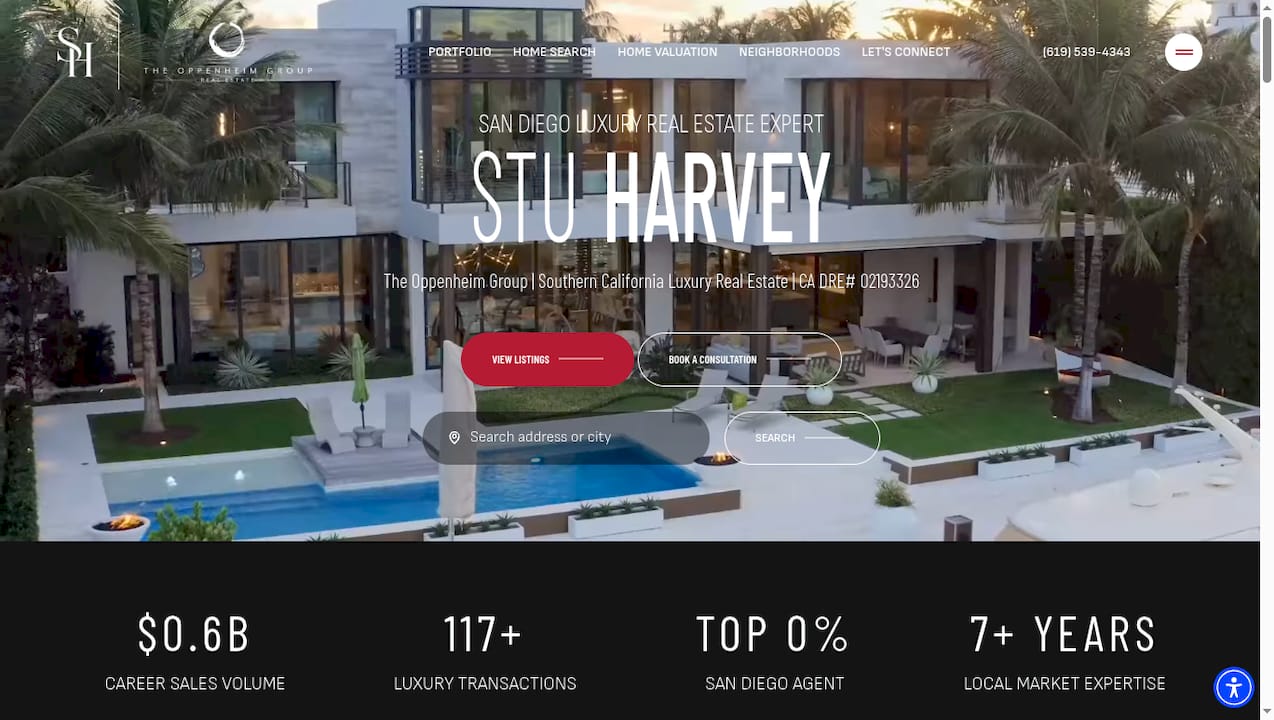
Stu Harvey Estates specializes in ocean-proximate luxury properties across San Diego, Los Angeles, Orange County, and Southern California, with over $1.2 billion in completed transactions and more than 250 luxury closings. That depth of experience means clients get specific guidance on flood zone implications, insurance referrals, elevation certificate interpretation, and neighborhood-level pricing dynamics, not generic advice that could apply anywhere.
Whether you are buying a sea-view property for the first time or selling a coastal home in a market where insurance costs are changing the buyer pool, the right agent makes the difference between a transaction that closes cleanly and one that falls apart at inspection or financing. Browse current coastal listings or connect with Stu Harvey directly for a personalized market analysis of any Southern California coastal property.
Primary sources and recommended further reading
The sources below are organized by type: data and mapping tools versus interpretive studies.
Data and mapping sources:
- NOAA Tide Gauges and Sea-Level Data — local sea-level trend data by coastal station; the standard input for exposure measurement
- FEMA Flood Map Service Center (msc.fema.gov) — flood zone designations and Base Flood Elevation data for any U.S. address
- ClimateCheck — property-level composite risk scores for flood, sea-level, and storm exposure; useful as a first-screen tool
Peer-reviewed and academic studies:
- Miller & Sklarz: The Impact of Waterfront Location on Residential Home Values Considering Flood Risks — non-linear proximity premiums and post-storm discount dynamics
- Land Economics: Pricing Coastal Amenities and Flood Hazards — viewshed-based hedonic estimates for CT and MA; 33%–69% view premium range
- Land Economics: The Value of a Sea View (GIS/NLP) — 8.1% average sea-view premium; 15% for wide view breadth; 100,000+ listings
Policy and risk analysis:
- Yale School of Management: Rising Seas and Coastal Property Values — national aggregate finding on sea-level rise and price trends
- Union of Concerned Scientists: Sea Level Rise and U.S. Coastal Real Estate — scenario-based maps and long-term exposure analysis
- NRDC: Costs of Coastal Flood Risk and Adaptation — policy context on mitigation costs and who bears them
- Barr Foundation: Massive Risk to Coastal Property from Sea-Level Rise — synthesis of high-exposure scenario studies
This article is general information, not a substitute for advice from a qualified financial advisor. Consult a qualified financial professional about your own circumstances before acting on anything here.
Sources
- The Impact of Waterfront Location on Residential Home Values Considering Flood Risks
- Study: Rising Seas Aren't Causing Coastal Property Values to ...
- Pricing Coastal Amenities and Flood Hazards | Land Economics
- Oceanservice